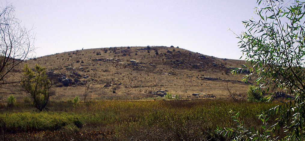
A newspaper editor I once worked with told me there was a story behind every place-name in San Diego County. And my research has borne that out.
Ever wonder who the Felicita was behind Felicita Park? Or the Warner behind Warner Springs? Those are just two of many examples.
Join your History Seeker as I reveal the people behind the place-names for my talk, “Who Were Those People?” on Wednesday, July 8 at 10 a.m. at Oasis Rancho Bernardo Lifelong Learning Center. Click on the link below to sign up:
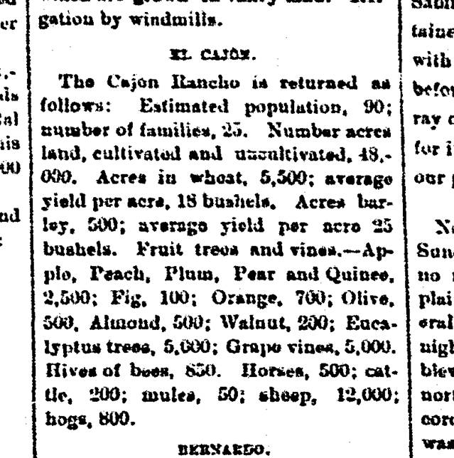
Here’s a verbal snapshot of a part of our county from a different time. Below is an excerpt from the front page of The San Diego Union of January 16, 1877, presenting a summary of San Diego County’s agricultural output for the previous year. This clip covers El Cajon, or as they referred to it then, the “El Cajon Rancho,” but the language and descriptions were similar for all the communities covered in terms of what was then a predominantly rural county where the livestock still outnumbered the humans. Note the number of horses, cattle, sheep and hogs versus the 90 humans. As of the 2020 U.S. Census, the population of the city of El Cajon stood at 106,215! Have a good read and then, take a walk outside and look around you.
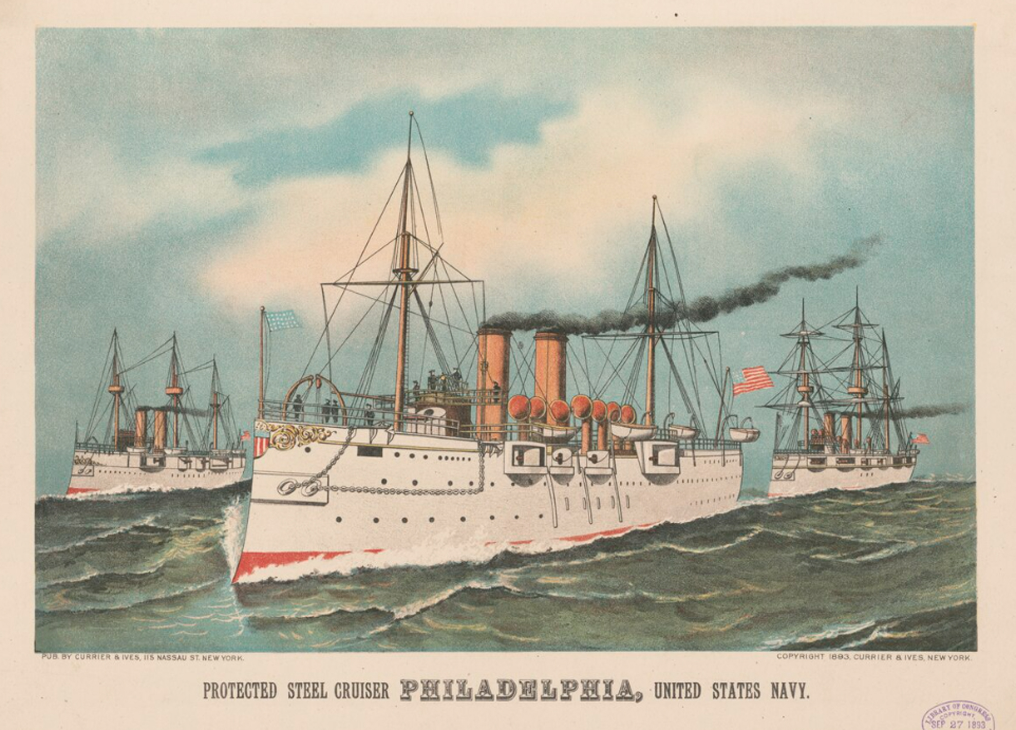
Accounts of San Diego becoming a Navy town usually begin with the creation of Naval Base San Diego in 1922. With its fine natural harbor, San Diego and its residents were welcoming navies going back to the Spanish. U.S. Navy ships were already a big attraction in the late 1800s, as evidenced by reports in local newspapers in February 1896.
In an article headlined, “Excursion to San Diego,” The Escondido Times-Advocate of Friday, February 7, 1896, reported “The U.S. warships, Philadelphia, Albatross and Monterey, will be in San Diego on Saturday, February 8th, on which date the Southern California Railway will sell tickets at one fare for the round trip, with return limit of February 18th.”
Here’s an 1893 Currier and Ives print of the USS Philadelphia, courtesy of the Library of Congress:
The Philadelphia,The Times-Advocate noted, “is one of the largest war vessels ever in San Diego Harbor, and it is expected will attract a large number of visitors. There will be a grand naval and military parade at 2:30 p.m. and a grand military ball at Coronado on the evening of the 8th.”
The San Diego Sun, in its issue also dated Friday, the 7th, perhaps because it was a little closer to the action, reported that all the ships had apparently arrived in the early hours of Friday morning, the Monterey arriving “at Point Loma this morning at 4. After daylight she was brought into the harbor. When off beacon No. 6, the Monterey fired a salute in recognition of the flagship Philadelphia, and a few moments later both the Philadelphia and Albatross fired a reply of seven guns.” The volley from the ships, the Sun noted, “brought a great many people to the water front and the wharves were crowded even before the monitor [referring to the Monterey] had anchored.”
A separate article in the Sun on the planned parade and ball, regarding the number of out-of-town visitors expected, reported that “the Southern California people say they expect from 600 to 800, from what they hear,” and that “over 400 tickets have already been issued” for the ball at the Hotel del Coronado.
It’s been a long time, too long, since my last blog post. I was reminded of that this morning on a visit to Old Poway Park. My wife and I went to the park to attend a folk music festival and then visit the farmer’s market. We ran into an old acquaintance, Joe. He asked me, “How’s the writing going?” and reminded me that he’d bought and read several of my previous local history books and was a reader of my blog.
Joe is a farmer with a stand at the Poway market. He reminded me about how striking it was that beets were a big product in the town of Bernardo in the early 1900s. I had covered that in my book Once Upon A Town: Bernardo, Merton and Stowe.
One passage in the book reads:
” ‘Sugar Beets Prove Success at Bernardo,’ was the headline of an article in the San Diego Union on New Year’s Day, 1915. Twelve [railroad] carloads averaging about fifty tons to the car were shipped by U.S. Weaver,” read the article, which also listed a hay crop of 6,000 tons, 10.000 sacks of grain, and two to five carloads of honey coming from the community….”
Thank you, Farmer Joe, for your terrific memory. Thank you also for your work growing food for your family and for your community. I pledge to work with renewed energy in harvesting historical knowledge as you work to harvest your crops.
Today is Indigenous Heritage Day, a day for remembering the indigenous civilization living here in San Diego County thousands of years before Europeans arrived. The following two links offer further info into the movement by which the descendants of our county’s original residents have reasserted their historical legacy and assumed agency over their history and their future.
The first is a link to the resolution adopted by San Diego State University in 2019, acknowledging the legacy of the university’s site as Kumeyaay land:
And this is the link to the website of the California Indian Culture and Sovereignty Center at California State University San Marcos. If you go to the site and then click on “Land Acknowledgement”, you’ll see an explanation of the agreement acknowledging the Cal State site’s legacy as “the traditional territory of the Luiseño/Payómkawichum people.”